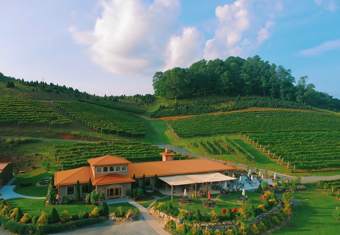
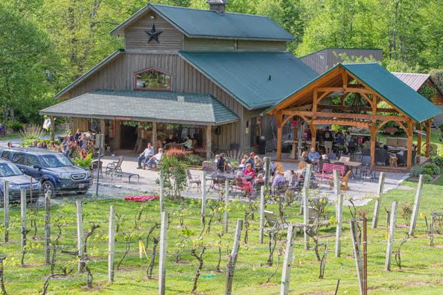
Linville Falls WineryPlan your trip to Wilson Creek Cabins pet friendly cabin rentals near Blowing Rock and take a day to explore the NC Mountains Wineries and scenic beauty. First stop is Linville Winery: LINVILLE FALLS WINERYlinvillefallswinery.com (828) 765-1400 – Tasting Room 9557 Linville Falls Highway, Linville Falls, NC 28647 Linville Falls Winery is part of a 40 acre family owned and operated farm in the Blue Ridge mountains. Just off of the Blue Ridge parkway, the winery is in a great location to enjoy the outdoors while sipping on mountain-grown wine. Elevate your taste with us! Grandfather VineyardNext on the tour is the Grandfather Vineyard! GRANDFATHER VINEYARDgrandfathervineyard.com (828) 963-2400 – Tasting Room 225 Vineyard Lane, Banner Elk, NC 28604 Our terraced mountain vineyard & winery is nestled along the Watauga River at the base of Grandfather Mountain. We are the first producing winery in Watauga County, NC. Warm breezes during the day and cool, crisp nights help develop the flavors and balance of our wine. Enjoy and share with friends. Banner Elk WineryLast stop on the trail is in beautiful Banner Elk near the ski slopes! BANNER ELK WINERY bannerelkwinery.com (828) 898-9090 – Tasting Room Pisgah National Forest, 135 Deer Run Rd, Banner Elk, NC 28604 Nestled in the awe inspiring majestic Blue Ridge Mountains stands North Carolina High Country’s original winery. Come for a tasting or a tour, or perhaps stay the night at our Tuscan-inspired Villa. A private retreat with luxury accommodation, beautiful scenery, and warm hospitality in an idyllic setting. PLAN YOUR WINE TRAIL TRIP:
Before you begin check the individual wineries website for a complete listing of contact information and hours of operation. Each winery may also be hosting special events that you will not want to miss! YOU HAVE THE TIME AND WE HAVE THE WINE!The trail offers an exciting wine-lovers getaway adventure to four incredible wineries that grace the hills from Banner Elk to Foscoe to Linville Falls and onward to Watauga Lake. The High Country Wine Trail offers you a passport that entitles you to receive a special thank you gift when you complete the tour and visit all four wineries. The five wineries include Banner Elk Winery in Banner Elk, NC; Grandfather Vineyard & Winery in Foscoe, NC; Linville Falls Winery in Linville Falls, NC, and their Tennessee cousins, Watauga Lake Winery and Villa Nove Vineyards Farm Winery in Butler, TN. Each winery is known for their distinctive wines produced from the grapes grown in the Appalachian High Country American Viticulture Area. All you have to do is hit the trail and you will experience Wine with a View!
5 Comments
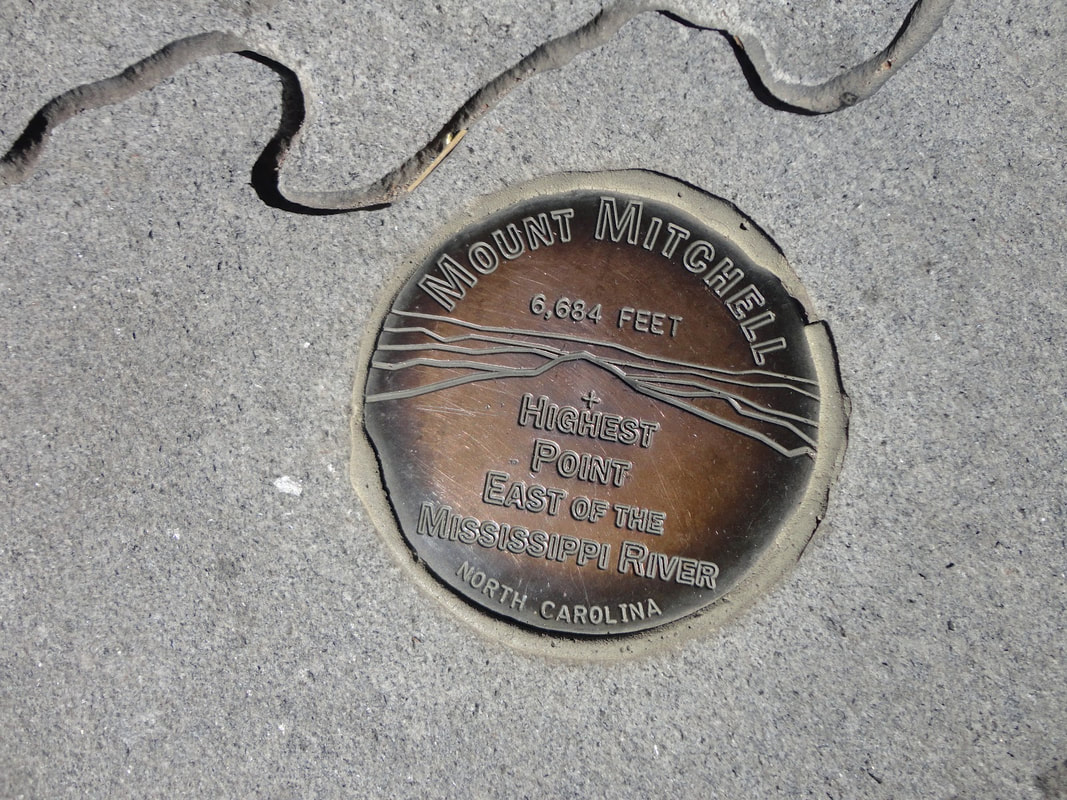
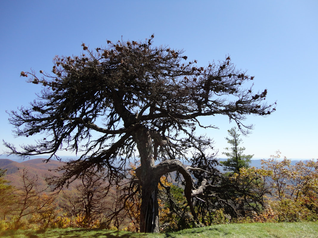
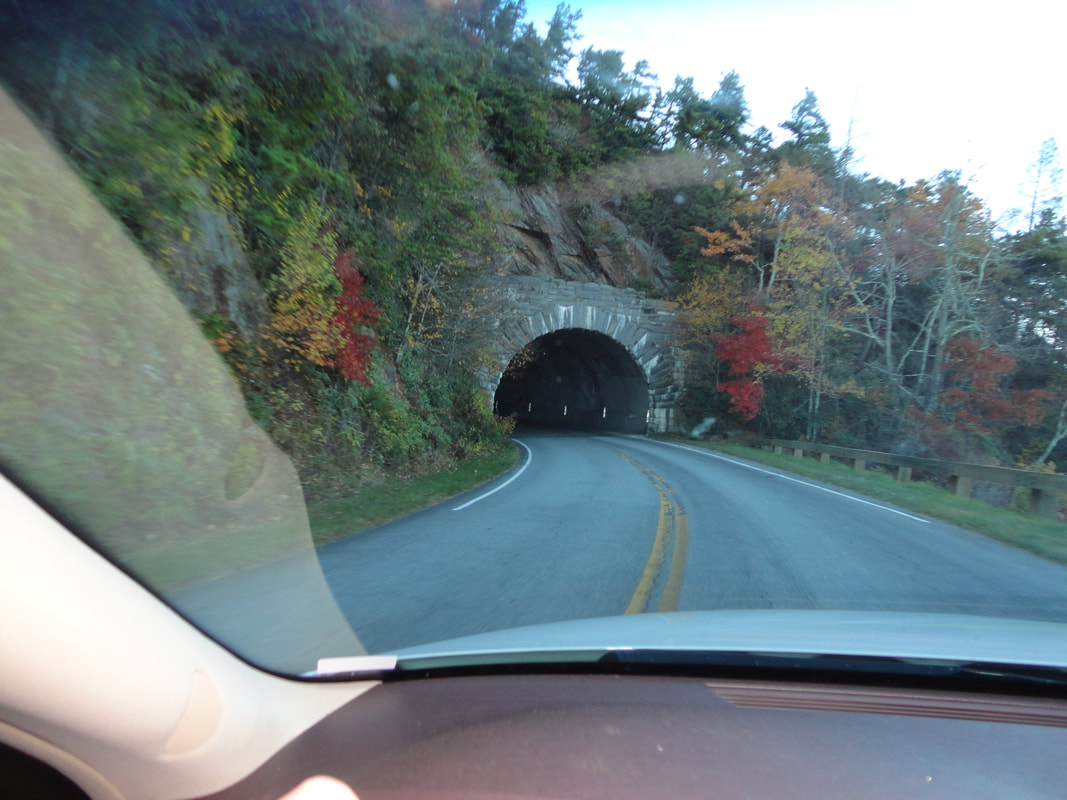
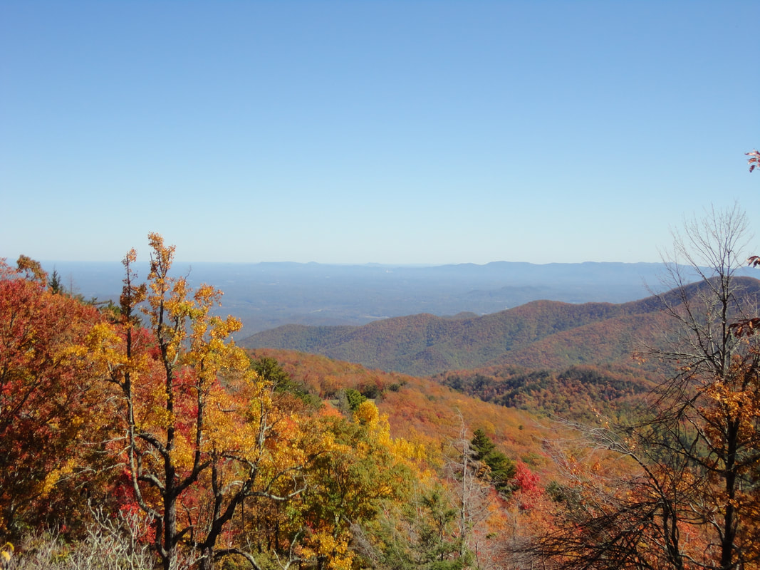
A guest favorite excursion from WilsonCreekCabins.com is a trip up the Blue Ridge parkway to see the Highest Peak in the East at a whopping 6684 ft above sea level! Drive to the parking area and there is a Gift Shop and Information Center to explore and then the short Hike to the Lookout Tower with 360 degree views and unlimited distance as far as the eye can see on a clear day! It is acceptable to bring your dog on a leash as well and there are spots for a picnic and take in the beauty and serenity of the sounds above the world. 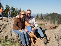 See natures effects of Acid rain at these high elevations and vistas and colors in fall for miles all around! The trip up the parkway is loaded with tunnels and turnout parking areas for a quick view and stretch your legs! See lots of tunnels and the view on the Blue Ridge Parkways is a destination in itself. Long range views and breezes and a different thermo-cline means dress accordingly its a different world up here!
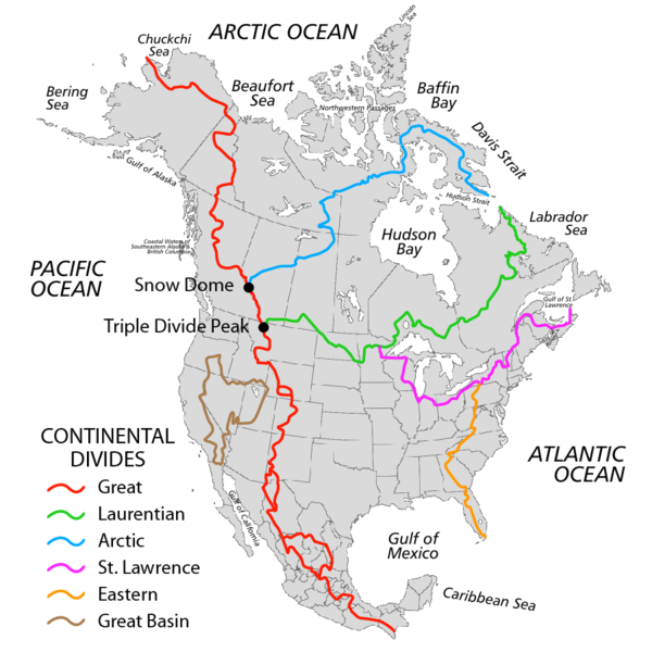
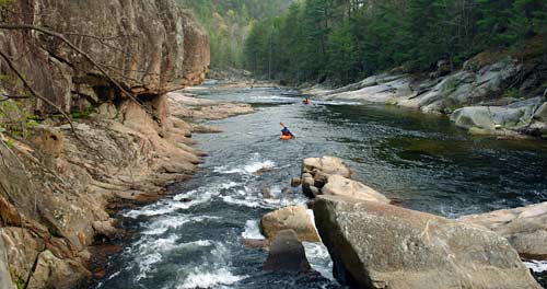
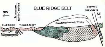
Eastern US Continental Divide near Grandfather MtnMap of the North American Continental DividesThe Continental Divide is the water shed flow of water from mountain ranges around the world. Below is the picture from the Divides in North America. Wilsoncreekcabins.com Pet friendly cabins near Blowing Rock are located in The Wilson Creek Wild and Scenic River Gorge which starts at the top of Grandfather Mountain and traverses through the Brown Mountain area which is part of the Grandfather Mountain Ranger district and surrounded by Pisgah National Forest. The Blue Ridge Mountains of western North Carolina and Eastern Tennessee are the result of the action of plate tectonics. The crust of our planet is composed of five primary plates, or huge pieces of rock which move very slowly over deeper layers of hot, pliable rock. Here you can see how the Appalachains were formed. Some of the plates are composed of heavy oceanic crust, while others are made of lighter continental crust. At the middle of each oceanic plate a large crack pours forth lava onto the ocean floor. This causes oceanic plates to expand an inch or two every year. When oceanic crust is forced against continental crust, the oceanic crust is pushed underneath the continental crust. When continental crust is forced against continental crust, huge mountains usually are formed. The Appalachian Mountains were formed in the remote past by collision of two continental crusts. During such mountain building, huge sheets of rock are pushed over each other. A rock layer called the Blue Ridge Thrust Sheet was moved over 60 miles to cover what is now Grandfather Mountain. These mountains were once much higher (10 times as high!) than they are today. Erosion over hundreds of millions of years has carried away most of the rocks to form thick layers of sediment all across the Piedmont, Coastal Plain, and in the Atlantic Ocean. At Grandfather mountain, erosion has worn away the Blue Ridge Thrust Sheet from over top of the underlying older rock, allowing us to study them. Geologists call this a “window” in time. The first Billion Years! 23.3-mile mountain stream, Wilson Creek was added to the National Wild and Scenic River System in 2000. Much of Wilson Creek lies within the Pisgah National Forest. The stream starts atop 5,920-foot high Grandfather Mountain, just 100 yards above the Blue Ridge Parkway. Twenty miles later, the headwaters rush through the Blue Ridge Mountains into a 200-foot deep gorge of granite bedrock. The Wilson Creek Wild and Scenic River gorge is one of North Carolina's best kept secrets for the natural beauty and unspoiled commercialism. The river and terrain has been a family favorite spot for exploring in the great Pisgah National Forest part of the Blue Ridge Mountains. Here is a view of a kayaker taking in the beauty of the Gorge as the Wilson Creek has cut a path through the boulders and solid rock formations that are billions of years old. Thees are the oldest exposed rock formations and mountains in the world. For perfect home base accommodations to enjoy your Pet friendly Mountain cabin rentals near Boone and Blowing Rock visit: wilsoncreekcabins.com website. Tons of pic's video and details of the Wilson Creek River Gorge area and the fun stuff to do here. We are centrally located between Grandfather Mountain, Blowing Rock and Lenoir. A short drive to the parking area at Table Rock Park from Wilson Creek Cabins and your looking right into the Canyon!
Guests at Pet friendly Wilson Creek Cabins enjoy Rock Hounding for Gemstones. The applachains are some the oldest mountains in the world. These creeks and streams have exposed veins of gemstones and if you are lucky enough and know how to find them they are here. For vacationers we recommend the mines in Franklin NC and Hiddenite NC. Chances of finding a family treasure are there and the experience is great. Lifetime memories for kids and adults enjoy and treasure thier finds too. For the memorable Mountain Vacation fun for all ages come to the Wilson Creek Wild and Scenic Gorge and you never know you may stumble upon a tally whacker gem of your own.
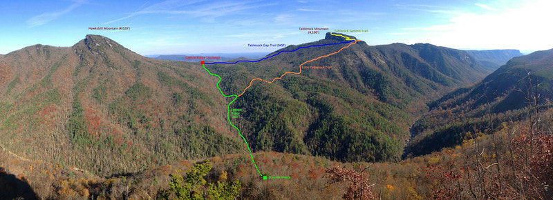
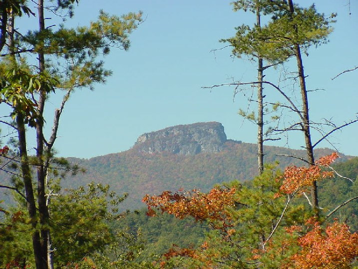
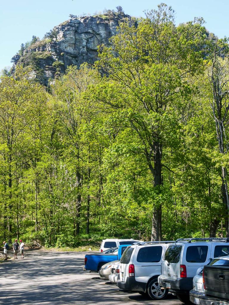
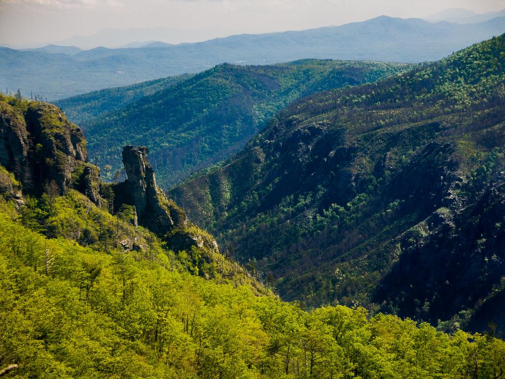
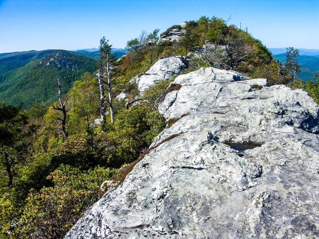
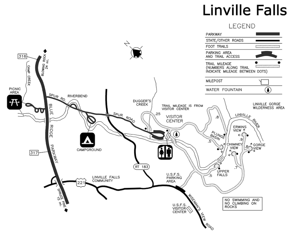
List of Gem Mines for your Rock Hounding Mountain Adventure:Gem Mines BooneFoggy Mountain Gem Mine About: Mostly imported gem ore from Brazil Address: 4416 Highway 105 South, Boone NC 28607 Telephone: 828-963-4367 Travel Time From Asheville: 2-21/2 hours west. River and Earth Adventures, Inc Gem Mine About: 90% imported gem ore from Brazil, some from local mines Address: 1655 Highway 105, Boone NC 28607 Telephone: 800-411-7238, 828-963-5491 Travel Time From Asheville: 2-21/2 hours west. CantonOld Pressley Sapphire Mine About: World's largest blue star sapphires were found at this mine. Only native gemstone ore. Address: 240 Old Pressley Mine Road, Canton NC 28716 Telephone: 828-648-6320 Travel Time From Asheville: 45 minutes west. FoscoeThe Greater Foscoe Mining Co. About: Indoor and outdoor flume gem mining. Native gem ore enriched with imported. Address: 8998 Highway 105 South, Foscoe NC 28604 Telephone: 828-963-5928 Travel Time From Asheville: 2 hours east Franklin Cherokee Ruby and Sapphire Mine About: Only native gemstone ore from the Cowee Valley. Address: 41 Cherokee Mine Road, Franklin NC 28734 Telephone: 828-349-2941 Travel Time From Asheville: 2 hours west Cowee Mountain Ruby Mine About: Native and imported gem ore . Address: 6771 Sylva Road, Franklin NC 28734 Telephone: 828-369-5271 Travel Time From Asheville: 2 hours west Gem Mine at Gem World About: Imported gem ore only from five different countries. Address: 1884 Georgia Road, Franklin NC 28734 Telephone: 828-349-5411 Travel Time From Asheville: 2 hours west Gold City Gem Mine About: Native and imported gem ore, gold panning. Address: 9410 Sylva Road, Franklin NC 28734 Telephone: 800-713-7767, 828-369-3905 Travel Time From Asheville: 2 hours west Mason's Ruby & Sapphire Mine About: Native gem ore where you dig your dirt from their own mine. Address: 6961 Upper Burningtown Road, Franklin NC 28734 Telephone: 828-369-9742 Travel Time From Asheville: 2 hours west Mason Mountain Mine & Cowee Gift Shop About: Native gem ore where you dig your dirt from their own mine. Also enriched buckets with imported ore. Address: 5315 Bryson City Road, Franklin NC 28734 Telephone: 828-524-4570 Travel Time From Asheville: 2 hours west Rose Creek Mine About: Native gem ore where you dig your own dirt from their own mine. Address: 115 Terrace Ridge Drive, Franklin NC 28734 Telephone: 828-349-3774 Travel Time From Asheville: 2 hours west Sheffield Mine About: Native ruby and sapphire gem ore from their own mine. Address: 385 Sheffield Farms Road, Franklin NC 28734 Telephone: 828-369-8383 Travel Time From Asheville: 2 hours west HendersonvilleElijah Mountain Gem Mine About: Imported gem ore only. Address: 2120 Brevard Road, Hendersonville NC 28739 Telephone: 828-693-3123 Travel Time From Asheville: 30 minutes south HiddeniteEmerald Hollow Mine About: Native gem ore, including emeralds, from their own mine. Address: 484 Emerald Hollow Mine Drive, Hiddenite NC 28636 Telephone: 866-600-4367 Travel Time From Asheville: 1 -11/2 hours east Jefferson Gem Valley NCAbout: Native gem ore, some imported Address: 2489 Little Peak Creek Road, Jefferson NC 28640 Telephone: 336-982-5177 Travel Time From Asheville: 3 hours east MarionHeather Grove Gold & Gem Panning About: Native and imported gem ores and local gold Address: 43 Polly Spout Road, Marion NC 28752 Telephone: 828-738-3573 Travel Time From Asheville: 1 hour east The Lucky Strike Gold and Gem MineAbout: Native and imported gem ores, gold panning in the Second Broad River. Campground. Address: 251 Lucky Strike Lane, Marion NC 28752 Telephone: 828-738-4893 Travel Time From Asheville: 1 hour east Little Switzerland: The Emerald Mine of Little SwitzerlandAbout: Native and imported gem ore, two dig sites. Address: 74 George Street off of McKinney Mine Road, Little Switzerland NC 28749 Telephone: 828-765-6832 Travel Time From Asheville: 1 -11/2 hours east Spruce Pine:Emerald Village About: Native gem ore from their mine and other area mines. Address: 331 McKinney Mine Road, Spruce Pine NC 28777 Telephone: 828-765-6463, 828-765-0000 Travel Time From Asheville: 1 -11/2 hours east Gem Mountain Gemstone Mine About: Covered flumes. Gem ore brought in daily from mines. Address: Highway 226, Spruce Pine NC 28777 Telephone: 888-817-5829 Travel Time From Asheville: 1 -11/2 hours east Rio Doce Gem Mine About: Native and imported (Brazil) gem ore Address: 14622 Highway 226 South, Spruce Pine NC 28777 Telephone: 828-765-2099 Travel Time From Asheville: 1 -11/2 hours east Spruce Pine Gemstone Mine About: Native gem ore from local gem mines. Address: 15090 Highway 226 South, Spruce Pine NC 28777 Telephone: 828-765-7981 Travel Time From Asheville: 1 -11/2 hours east Union MillsThermal City Gold Mine About: Panning for gold from ore from their site. Gem ore from native and imported sources. Address: 5240 US Highway 221 North, Union Mills NC 28167 Telephone: 828-286-3016 Travel Time From Asheville: 1 -11/2 hours southeast Gem Shops Asheville The Silver Armadillo West Gate Shopping Center, Asheville NC; 828-253-3020 Franklin Burglens Natural Gems 5868 Sylva Road, Franklin NC 28744; 828-524-9171 Cowee Gift Shop 5315 Bryson City Road, 828-524-4570 Cowee Mountain Ruby Mine & Gift Shop 6771 Sylva Road, Franklin NC 28734, 828-369-571 Franklin Gemstone & Jewelry Warehouse 3002 Georgia Road, Franklin NC 28734, 828-524-6132 Gold City Jewelry & Gem Shop 9410 Sylva Road, Franklin NC 28734, 828-369-3905 Ruby City Gems & Minerals 130 East Main Street, Franklin NC 28734; 828-524-3967 Tari's RokGem 1884 Georgia Road, Franklin NC 28734; 828-349-5411 For Pet Friendly Vacation Rentals homes in the Wilson Creek Wild and Scenic River Gorge:check us out at: www.wilsoncreekcabins.com Table Rock hiking excursionTable Rock Park parking area is a short 45 min drive from Wilson Creek Cabins pet friendly cabins near Blowing Rock and Boone. Begin the hike at the north end of the parking lot (the side away from the toilets). The trail is located to the right of the sign board. The ridge of Table Rock looms high above the parking area right from the start. The trail starts out level, but very quickly begins its steep, mostly relentless climb to the top. Not only is it steep, but it quickly becomes very rocky, with some large stepping stones that have become dislodged and loose due to heavy hiker traffic. Some stretches of trail sport smooth, sloping rock, so watch your footing to avoid a slip. The beginning of the trail is in a forest of medium-height hardwood trees; mostly oaks. A few hemlocks and white pines grow in the understory, hoping to overtake the hardwoods and poke out into the sun some decades into the future. But the forest quickly changes, and the trail becomes more open and sunny. In years past, this area was a forest, composed primarily of a species scraggly tree called Table Mountain Pine. But many of those have died as a result of an infestation of the native Southern Pine Beetle. Only the gnarled trunks now remain. Luckily, this insect has evolved along with the pines, so the trees aren't all killed by an infestation. Sparse sections of healthy pine forest can still be found. This forest has also been affected by fire. In fact, these pines need fires periodically to open their cones and regenerate from seed. Along the way, you'll see signs explaining fire ecology which mention this fact. Aside from the pines, trailside vegetation consists mostly of rhododendron and mountain laurel. They are prolific, and bloom relatively early here (late May), which is an excellent time to hike this trail. Parking lot below: 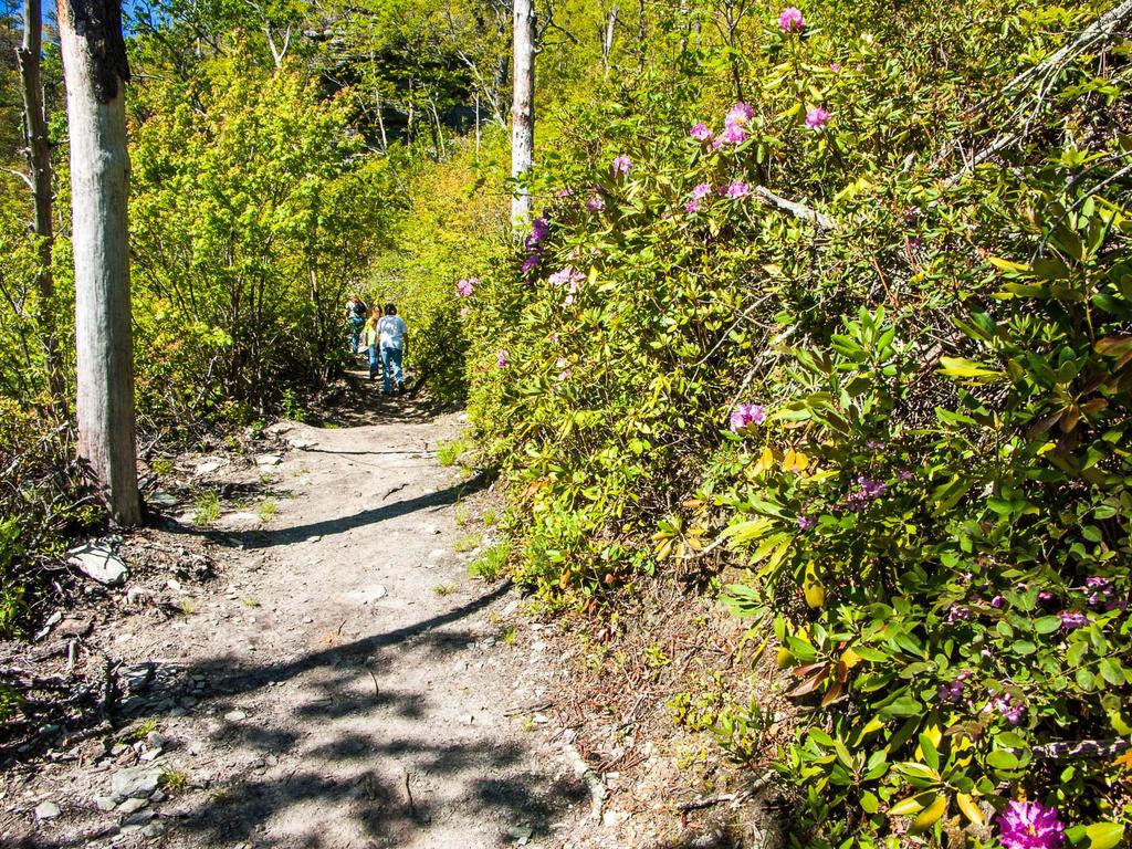 To your left, a nice view opens up through the sparse trees of the Linville Gorge and - to the far left - the Chimneys. These rock formations are some of the closest features we have in the Appalachians to "hoodoos" so common out west - pillars of rock standing apart from a main cliff face, formed by erosion. They are a popular rock climbing destination (as is Table Rock itself) and even have a connection to the famous Linville Falls some miles up the Linville River from this location. Linville Gorge was formed as the Linville River cut down through a hard, resistant layer of rock into the softer rocks below. Where the river flows over this layer near the top of the gorge, it forms Linville Falls. The Chimneys, Table Rock, Hawksbill Mountain (which you will see once you reach the top), and all the high cliffs near the rim of the Gorge are all formed as a result of that same ancient, erosion-resistant layer of rock. As you ascend, and once you reach the top, keep your eyes peeled for the elusive Peregrine Falcon. These graceful, large raptors are native to the area. They are, in fact, widespread across much of the world. But they were eliminated regionally during the 20th century due to the effects of DDT. Since then, they've been reintroduced to the area successfully and are still protected. Rock climbing routes near their high, windy cliff-side nesting sites are closed periodically to ensure that the birds are able to hatch and raise their offspring in peace. The Peregrine's most well-known feature is their hunting style: taking other birds in mid-flight, they dive from high above, striking their prey at literally breakneck speeds. Near the summit, you start to get views back down into the gorge, such as this one of an adjacent cliff face covered with blooming rhododendron and azalea.The trail will go around a ridge and curve to the right. An intersection with a faint path - the old Little Table Rock trail - is at the top of the ridge; bear right, uphill. You will immediately pass onto a cooler, wetter slope of the mountain. Here, Carolina Hemlocks grow among the pines and hardwoods (or grew - they may be dead by the time you hike here) with a few Eastern hemlocks as well. Both hemlock species are being ravaged by the Hemlock Wooly Adelgid, a non-native pest that has a lot less mercy on its host than the pine beetles have. There is another intersection on the left; this time, with the Mountains to Sea Trail. Bear right, uphill. The trail switches back again, climbing in earnest, and goes back onto the open, sunny south side of the mountain. The trail climbs steeply along much of the remainder of the route. Several rock formations stand out along this section of trail. At one point, the trail passes through a neat slot formed by a large boulder that has split away from the main rock face. As you approach the top, the vegetation gets reduced down to very short, gnarled growth. It's mostly shrubs with a few stunted trees. The trail officially ends on a small flat area where an observation tower once stood. Despite the tower's absence, views are to be had in every direction, and they are spectacular. You can travel along the ridge to the south if you're willing to scramble and climb over some very rough rocks. Keep in mind that there are sheer cliffs in almost all directions from the top and stay well back away from the edges. Also, obey any signs posted regarding closures for the Peregrine Falcons during the spring nesting season. Table Rock Park is pet friendly but bring your pet on leash, there are drop offs and dangerous cliffs and you want to have fun without any accidents! Guests staying at pet friendly Wilson Creek Cabins in the Wild and Scenic River Gorge below Grandfather Mountain have a getaway that is hard to duplicate. Secluded properties in Natures beauty and terrific outdoor covered lounges by the creek for grilling and chilling after a fun day on the trails! list www.wilsoncreekcabins.com to see our cozy homes in the Gorge! See the video below to experience the Grand Canyon of the East!: Wilson Creek Cabins pet friendly cabins near Blowing Rock guests love Linville Falls..... it's the most popular waterfall in the Blue Ridge Mountains because of its accessibility to the Blue Ridge Parkway. It is a spectacular three-tiered waterfall plunging into Linville Gorge, the “Grand Canyon of the Southern Appalachians.” The Falls Trail distance is 1.6 miles round trip and easy. The Gorge Trail distance is 1.4 miles round trip and strenuous. The Plunge Basin Trail is 1 mile round trip and moderate. Pets are welcome but must be on a leash. The Visitor's Center is at Mile Marker 316. Find information on the two hiking trails and map at https://www.nps.gov/blri/planyourvisit/linville-falls-trails.htm. Linville Falls Hiking MapLinville Falls Hiking Trails Two main hiking trails lead to views of Linville falls. Both begin at the Linville Falls Visitor Center and pass through remnants of a virgin hemlock forest mixed with other familiar tree species such as white pine, oaks, hickory, and birch. A colorful and varied display of wildflowers decorates the trails in spring. Red and golden leaves in fall beautifully contrast with the soothing green of hemlocks. The Linville Falls trails range in difficulty from moderate to strenuous. Erwins View Trail A moderate 1.6 mile round-trip walk, offering hikers four overlooks, each revealing a different aspect of the Linville Falls area. The first overlook is 0.5 miles from the visitor center, and is a moderate walk with a slight loss of elevation. Here, the Linville River spills gently over the upper falls where it widens and pauses. Drifting into a narrow canyon, the water suddenly spirals out of sight and plunges 45 feet over the lower falls. The next overlook, Chimney View, 0.7 miles from the visitor center, is the first point on the trail where the lower falls can be seen. It offers an excellent change to photograph both the upper and lower falls. The overlook is named for the chimney-like rock outcroppings located to the right of the waterfall. The trail is strenuous in this area with considerable elevation gain. At Gorge View Overlook, hikers can see the Linville River cutting its way through the Linville Gorge Wilderness Area. The Erwins View Trail ends at Erwins View Overlook, 0.8 mile from the visitor center. From this vantage point hikers can enjoy a panoramic view of the Linville Gorge and a distant view of the upper and lower falls. Linville Gorge Trail The trails to Linville Gorge (1.4 miles round trip) and to Plunge Basin (1 mile round trip) also start at the visitor center. The trail to Linville Gorge forks 0.2 mile from the visitor center. The right fork takes hikers to Plunge Basin Overlook where they can view the lower falls and the Chimneys. The left fork winds down through rock cliffs to the bottom of the falls where the force of the water cascading over the falls creates a large pool. Both of these trails are strenuous. Swimming in the Linville River and climbing on the rocks is dangerous and not allowed. Make your plans for a mountain excursion and enjoy our pet friendly accommodations at WilsonCreekCabins.com for a great relaxing getaway! |
AuthorJeff Shook - owner I dreamed of owning Brown Mountain Lodge as a kid. In 2000 my wife and I purchased it and began our restoration and expansion of the home to share with guests the memories and good times of the Wilson Creek River Gorge area. In 2010 we opened my parents home place and named it Creekside Cozy Cabin. We invite you to experience the peace and serenity of the mountains for your next vacation getaway. Archives
January 2019
Categories |



 RSS Feed